Europa

Europa's Voyage

Below are two time lapse videos of Europa’s Voyage through The Papahānaumokuākea Marine National Monument. We had two cameras taking pictures from sunrise to sunset approximately every 1.5 to 3 hours.

The first video is from a camera mounted on the back end of the float. At the beginning of the journey you’ll see some ti leaves on the float. This was part of Europa’s blessing before embarking on her voyage through the PMNM. As you can see, Europa experienced some rough seas, beautiful sunrises and sunsets, full moons, and calm days with an occasional booby resting on the warm solar panels.

The second video is from a camera mounted in the float looking down at the sub and umbilical. You’ll note that the sub moves around quite a bit. There were times when the umbilical had slack and the wings were fully rotated up or down, indicating rough seas. Occasionally, fish even gathered around the sub.

Please enjoy the videos.


For a look back at Europa's prior journeys, check out our MAP and the Sea Surface Temperature (SST).

Aloha!

Subscribe to our blog

Land Ho, Land Ho!

Europa has finally made it home and was safely recovered March 14th. This type of survey throughout the pristine Papahānaumokuākea Marine National Monument has been the first of its kind. We are very proud of the mission and collaboration with the Navy and NOAA Sanctuary. Thank you all for following Europa’s journey.

 
Europa’s course navigating outside of the 200’ depth contour (red circles) throughout the PMNM

Europa’s course navigating outside of the 200’ depth contour (red circles) throughout the PMNM

 
Europa lays eyes on the Kohala Coast and Mauna Kea on the Big Island

Europa lays eyes on the Kohala Coast and Mauna Kea on the Big Island

Europa with view of Mauna Kea: Land Ho!

Europa with view of Mauna Kea: Land Ho!

 
View of Europa from the May Maru

View of Europa from the May Maru

Europa, moments before recovery on the May Maru

Europa, moments before recovery on the May Maru

 
Given the current Covid-19 pandemic, Europa follows appropriate bio-security protocol

Given the current Covid-19 pandemic, Europa follows appropriate bio-security protocol

She's not sure about coming to shore after her journey in the pristine, uninhabited, PMNM. Please stay safe!

She's not sure about coming to shore after her journey in the pristine, uninhabited, PMNM. Please stay safe!

 
Recovery crew: Beth, Maya, and Jessica (from left to right)

Recovery crew: Beth, Maya, and Jessica (from left to right)


For a look back at Europa's prior journeys, check out our MAP and the Sea Surface Temperature (SST).

Aloha!

Subscribe to our blog

Homeward Bound

Europa is on her way home after successfully surveying The Papahānaumokuākea National Marine Monument. As she exited the monument, she concluded with a cross through, and circle around, Middle Bank.

We expect to recover her in Puako sometime in the next 5-7 days, but the journey is not over yet. For this last leg, Europa has been faced with strong winds and high seas, as well as had to dodge a number of cargo and passenger vessels.

Today, a passenger vessel from the Bahamas, headed to Oahu, passed behind her. The vessel’s name was Europa, a good omen we hope!

The entire team from Jupiter, NOAA and the Navy anxiously await her recovery.

Stay tuned!

Europa passing through, and then circling, Middle Bank at the end of her PMNM journey.

Europa passing through, and then circling, Middle Bank at the end of her PMNM journey.

 
A look at all of the marine traffic that Europa is avoiding on her way back home to Puako. Each of those yellow and red dots represent a cluster of vessel breadcrumbs.

A look at all of the marine traffic that Europa is avoiding on her way back home to Puako. Each of those yellow and red dots represent a cluster of vessel breadcrumbs.

 
Europa vessel that passed by our wave glider Europa earlier today.

Europa vessel that passed by our wave glider Europa earlier today.

 
Sunrise from Europa in some heavy seas.

Sunrise from Europa in some heavy seas.

Moonrise (supermoon) from Europa with waves crashing.

Moonrise (supermoon) from Europa with waves crashing.


For a look back at Europa's prior journeys, check out our MAP and the Sea Surface Temperature (SST).

Aloha!

Subscribe to our blog

Aloha Raita Bank and Maro Reef

Europa has endured some strong winds and high seas the last few days as a cold front has moved from west to east across the chain. The sea surface temperature has also dropped a bit as we keep heading NW. We were a bit nervous as Europa tracked close to Maro Reef in search of humpbacks. Previous research has indicated that humpback whales frequent the waters surrounding Maro Reef. Humpbacks at Raita Bank have not been previously reported, possibly due to limited survey effort. Europa’s survey has confirmed an abundance of singing humpbacks as well as other odontocetes around Maro Reef and we are happy to report that Europa heard a fair number of humpbacks off Raita Bank as well. Again, this shows the enormous potential autonomous vehicles could have for studying whales in remote areas.

Picture of Europa’s course over the last two days. The red lines demark the 200’ depth line. We have defined this as our “exclusion zone” or safety margin. Alarms will be sent to our piloting team should Europa cross the line. As you can see, she is…

Picture of Europa’s course over the last two days. The red lines demark the 200’ depth line. We have defined this as our “exclusion zone” or safety margin. Alarms will be sent to our piloting team should Europa cross the line. As you can see, she is traveling quite close to shallow waters!

 
Maro_reef_Raita_bank.jpg

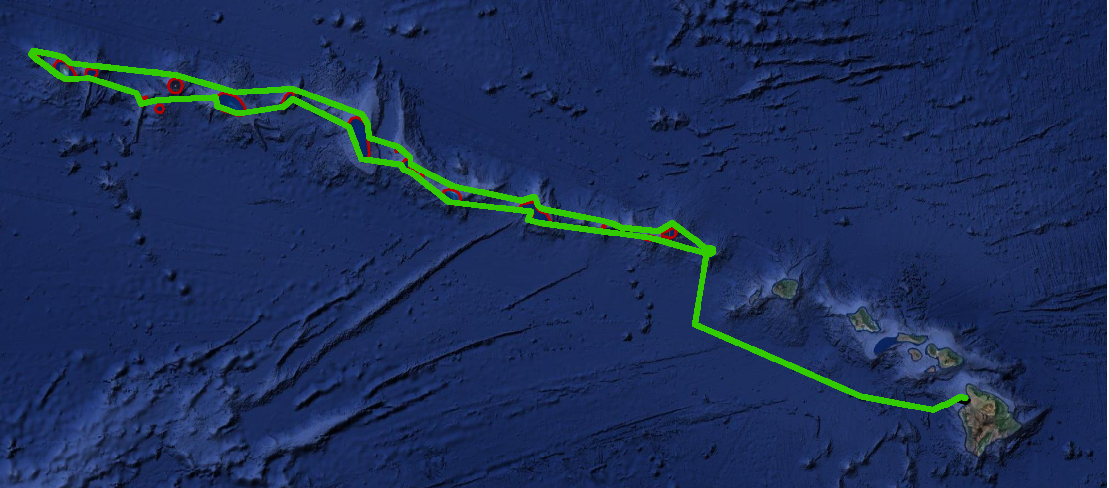
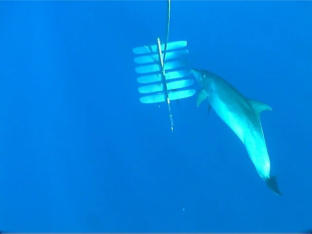
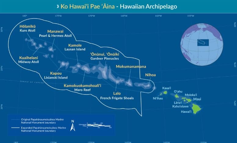
There are approximately 30 submerged banks in the Northwestern Hawaiian Islands. Up until recently very little was known about the banks beyond that they were shield volcanoes formed at the hotspot. Some scientists believe that many of the banks act as ‘stepping stones’ for marine organisms to migrate in the region. The bank areas provide extensive habitat for bottomfish and a few are known to provide foraging habitat for endangered Hawaiian monk seals. Large precious corals, such as gold, pink and black are also found in the deep waters of the banks. Unlike shallow reef corals which are able to harness sunlight as an energy source due to photosynthesizing symbiotic dinoflagellates in their tissues, deep-water precious corals live in near-total darkness and are completely dependent upon capturing plankton from the water column with their tentacles.

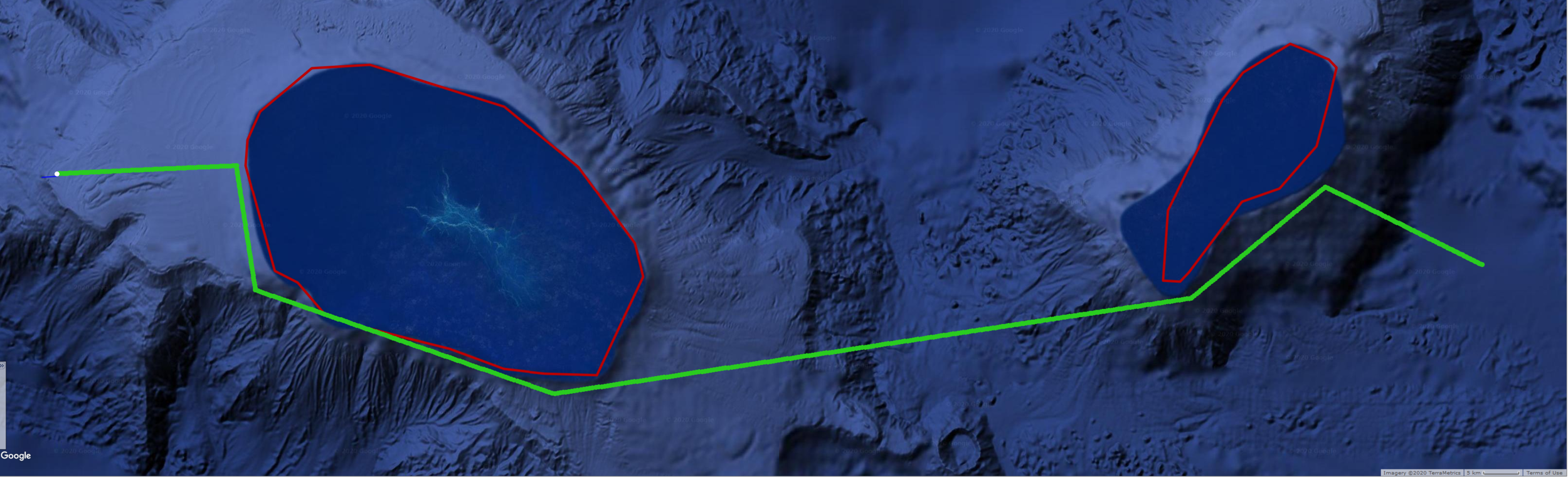
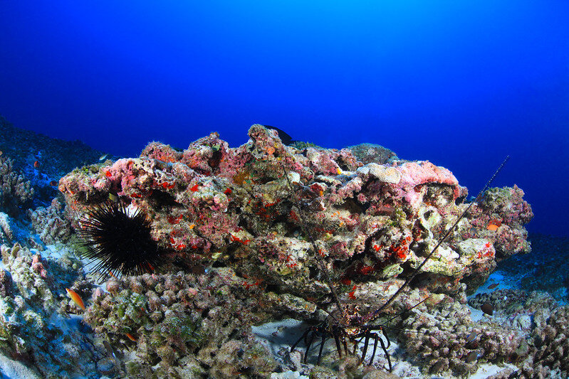
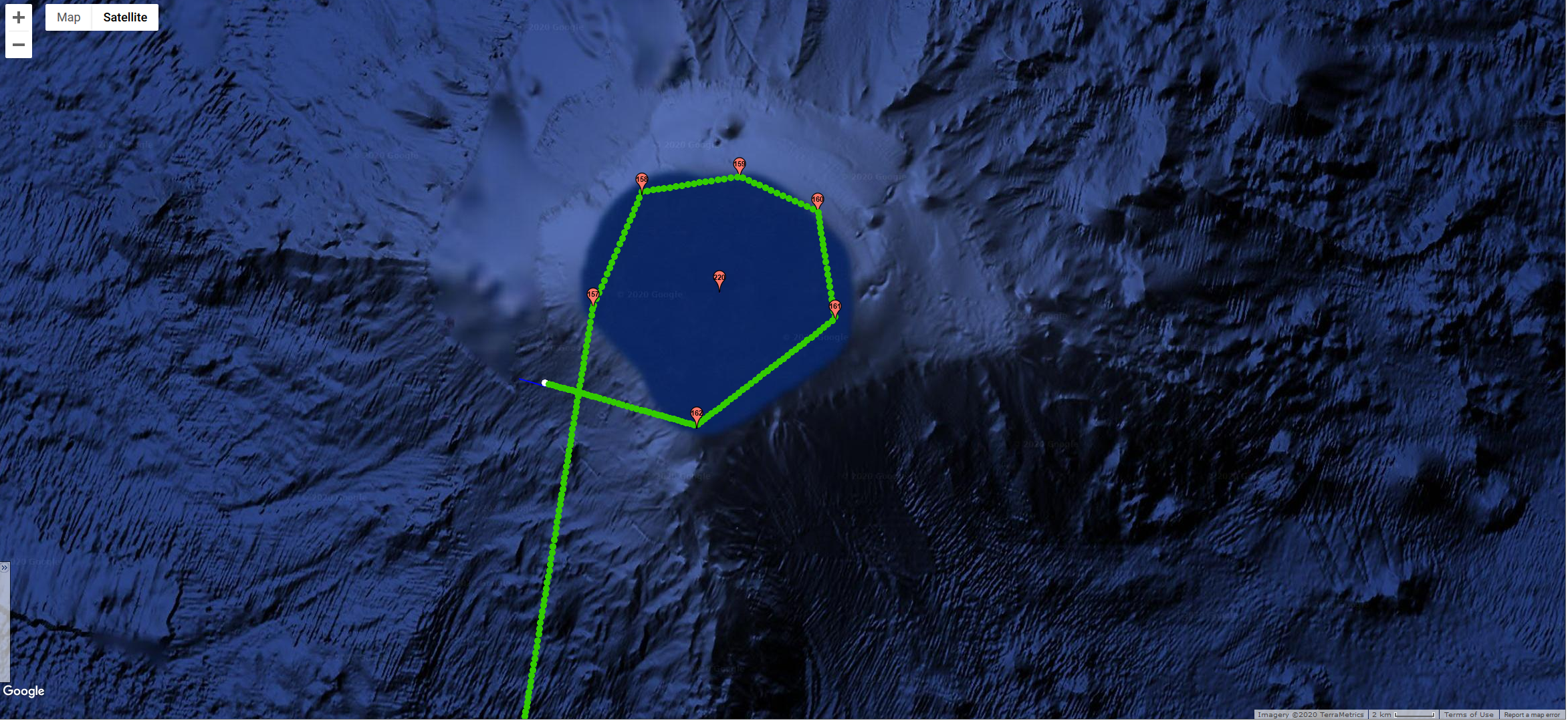
Raita Bank is just west of Gardner Pinnacles. The crest, or top, of Raita Bank is about 60 feet from the ocean surface. Bottom habitats of relatively shallow banks such as Raita tend to be barren when compared with more sheltered coral reef environments. Recent surveys revealed less than 1% live coral cover in the shallow portions of Raita Bank, with the bottom scoured by wave action and strong currents. Raita is one of the larger banks in the NWHI, and there is much yet to be discovered about this area.

Maro Reef spans 50 kilometers in length and 30 kilometers in width. Maro Reef is almost completely submerged with very few areas above sea level. The Hawaiian name for Maro Reef is Nalukākala. This name, translated as wave (nalu) and surf comber; to form combers; to blow in gusts (kākala), references the rough seas encountered here.

Maro Reef was named for the Nantucket whaling ship Maro which was the first American whaler to cross the mid-Pacific. This atoll is a hazard for navigators because the lack of visible landmarks makes it difficult to avoid grounding a ship on shallow areas of the reef. On October 8, 1957, the oil tanker USNS Mission San Miguel ran aground while running at full speed and sank here.

Photo by: Greg McFall/NOAA Office of National Marine SanctuariesA banded spiny lobster / ula (Panulirus marginatus) and a black spiny urchin / wana (Echinothrix diadema) at Maro Reef in Papahānaumokuākea Marine National Monument.

Photo by: Greg McFall/NOAA Office of National Marine Sanctuaries

A banded spiny lobster / ula (Panulirus marginatus) and a black spiny urchin / wana (Echinothrix diadema) at Maro Reef in Papahānaumokuākea Marine National Monument.

Maro, or Nalukākala, has the largest extent of coral reef habitat in Papahānaumokuākea and is one of the most ecologically rich locales in the Northwestern Hawaiian Islands. The shallow waters consist of patch reefs and elongate structures called spur and groove formations. The reefs support numerous butterflyfish and surgeonfish species. Grey reef sharks, galapagos sharks, whitetip reef sharks, trevally, jacks, and other apex predators are also numerous. Sharks and other apex predators play an important role in maintaining balance within marine ecosystems by regulating the populations of other species lower in the food chain. In the Hawaiian culture, manō are honored as akua (gods) and ‘aumakua (family guardians).


For a look back at Europa's prior journeys, check out our MAP and the Sea Surface Temperature (SST).

Aloha!

Subscribe to our blog

Feelin' Groovy

Europa has completed about one-third of her voyage north as she continues to cruise across deep ocean basins between the shallow banks, islands and atolls of PMNM. We monitor her health and download audio files and pictures of the sub daily. So far, we have posted some pretty interesting audio files. Below are some pictures of Europa’s sub showing the umbilical with tension and some slack. We painted one side of the umbilical so that we can tell if it gets any twist. Looking pretty straight now!!

Europa sub (PMNM)

Europa sub (PMNM)

Europa sub (PMNM)

Europa sub (PMNM)

Meanwhile, back in Puako, we were able to capture some pretty cool pictures off our Wave Glider, Metis, which is towing a hydrophone and streaming live whale song off Puako. These are of a bottlenose dolphin swimming around the sub, perhaps just curious or trying to catch one of the many fish that hang out around the vehicle. Something very similar has likely happened to Europa while transecting the environmentally rich waters of PMNM. Our hope is to get lucky enough to capture some images like these off Europa during her voyage.

Metis sub (Puako)

Metis sub (Puako)

Metis sub (Puako)

Metis sub (Puako)

Metis sub (Puako)

Metis sub (Puako)

Metis sub (Puako)

Metis sub (Puako)

Take a look and listen to the audio we captured at the moment when the bottlenose dolphin is hanging out with Metis.

Spectrogram of audio clip belowBottlenose dolphin with humpback whales chorusing in the background

Spectrogram of audio clip below

Bottlenose dolphin with humpback whales chorusing in the background


For a look back at Europa's prior journeys, check out our MAP and the Sea Surface Temperature (SST).

Aloha!

Subscribe to our blog

Europa Arrives In The PMNM

The Papahānaumokuākea Marine National Monument (PMNM) is located in the Northwestern Hawaiian Islands in the central North Pacific roughly 3,000 miles from the nearest continental land mass.

Map of PMNM

Map of PMNM

The PMNM is one of the largest fully protected conservation areas in the world. It encompasses 582,578 square miles (1,508,870 square kilometers) of the Pacific Ocean – an area nearly the size of the Gulf of Mexico!

The Monument, created expressly to protect an exceptional array of natural and cultural resources, was originally established on June 15, 2006 and expanded on August 26, 2016, both times under the authority of the Antiquities Act. It was inscribed as the nation’s first natural and cultural World Heritage Site in 2010.

This isolation has led to the evolution of many unique plants and animals. A significant amount of species within the Monument are endemic to Hawai‘i, found nowhere else on Earth. This area is also rich in ancient cultural sites and historic shipwrecks and landmarks.

Middle Bank is located between the islands of Niʿihau and Nihoa and straddles the boundary of the Monument. It is approximately 5-7 million years old, geologically, and one of several banks in the Monument that was created by volcanic activity and eventually subsided to the ocean. Middle Bank supports deep sea coral communities and bottomfish. The portions of Middle Bank outside of the boundary are occasionally fished for bottomfish.

Jan 21, 2020 - Europa navigating around Middle Bank

Jan 21, 2020 - Europa navigating around Middle Bank

On Jan. 21st, we piloted Europa around the outer edge of Middle Bank along the 200’ depth contour and heard some great humpback whale chorusing. Take a listen below.

20200121T161421_lots_hb_pod_spectrogram.JPG
 
20200121T191421_hb_spectrogram.JPG


For a look back at Europa's prior journeys, check out our MAP and the Sea Surface Temperature (SST).

Aloha!

Subscribe to our blog

Back to Hawaii

After 14 days of travel and adventure, we’re happy to say that Beth and Murray have touched ground back on the Big Island!

They successfully recovered Europa and all of the valuable scientific data that was collected on the mission. They then cleaned, disassembled, and packed up Europa in her entirety and shipped her home. She is expected to arrive on the Big Island within the next day or two.

For now, we are beginning to analyze the acoustic data. This is a pretty long and tedious task, but extremely valuable and necessary.

We have lots of video and pictures documenting the trip, and will post some of them in later updates.

Until then, check it out…we made the Marshall Islands newspaper!

Aloha!


For a look back at Europa's prior journeys, check out our MAP and the Sea Surface Temperature (SST).

Aloha!

Subscribe to our blog

A Successful Recovery

We just wanted to let everyone know that Europa was successfully recovered about 650nm north of the Marshall Islands on Friday afternoon.

Beth, Murray, and crew got Europa on board safely and without doing any damage to the glider. They’ve already began pulling off data and trying to diagnose what went wrong.

We don’t know much yet, but we’ll keep you posted!

As always, feel free to follow along on the journey at the HUMPACS page.

Aloha!

Beth and crew after successfully recovering Europa 650nm north of the Marshall Islands

Beth and crew after successfully recovering Europa 650nm north of the Marshall Islands


For a look back at Europa's prior journeys, check out our MAP and the Sea Surface Temperature (SST).

Aloha!

Subscribe to our blog

Hold On Europa, We're On Our Way!

As you all know from our last couple of blog posts, we lost control of Europa’s rudder module back on February 11, 2019, and have been putting our efforts towards recovering her since then.

Weather, logistics, and plenty of other things have been roadblocks, but we are now happy to report that WE ARE ON OUR WAY!

Europa_LifeRaft.png

This last Sunday, two members from our Hawaii team, Beth and Murray, started the journey to the Marshall Islands, and are now on a boat heading out into the deep blue sea to find and recover Europa. They are currently experiencing 22kt winds and 8-10'+ swells.

Fingers are crossed for good weather and safe travels; and of coarse, a successful recovery.

If things stay on schedule, we’ll hope to report back that the rescue mission has been a success in just a few days. We’ll definitely keep you all posted, but if you’d like to follow along as Beth and Murray make way, check out our HUMPACS map. You can click on the boat icon and see the distance until they reach Europa.

Ok, that’s it for now. Safe travels Beth and Murray!

Aloha!


For a look back at Europa's prior journeys, check out our MAP and the Sea Surface Temperature (SST).

Aloha!

Subscribe to our blog

Interested in Ocean Currents?

Not having control of the rudder module on Europa has really put the Jupiter team in a tough spot. We are completely at the mercy of the sea. For the past month we’ve continued to put our efforts towards recovering Europa, but we’re not there just yet.

In the mean time, we can still learn some things!

ocean-currents-sign.jpg

Like we mentioned in our last post, when we lost communication to the sub, the rudder automatically set itself in a “right rudder” position. Again, the goal is that it will do circles and stay in the same spot until it can either be fixed or recovered.

The ocean currents, however, have different plans!

If you’ve been following Europa you’ve noticed that it definitely hasn’t stayed in the same place. The currents are very strong out there in the middle of the Pacific Ocean, and even though Europa’s “right rudder” may slow things down, it’s not stopping the inevitable drifting to wherever the sea may take it.

 
The last 30 days of Europa’s travel, all of which it has been drifting with the ocean currents.

The last 30 days of Europa’s travel, all of which it has been drifting with the ocean currents.

 
Left: Zoomed in portion of the 30 day pictureRight: Even more zoomed in portion, representing about 2 days of drift

Left: Zoomed in portion of the 30 day picture

Right: Even more zoomed in portion, representing about 2 days of drift

As you can see, Europa is all over the place!

When we look a little closer, you get a really good idea of what’s happening out there. Currents can (and do) change all the time. For example, there might be a strong SW current in a location at noon, and then by 4pm it’s turned into a mild NW current.

Wind is the main contributor to surface ocean currents (the top 100m of the ocean). In the Northern Hemisphere, the winds basically circle in a clockwise motion. From East to West near the equator, and then from West to East up North. This helps to explain why Europa is drifting in a SW direction.

Actually, part of the reason we haven’t been able to recover Europa yet is due to the strong winds in the surrounding area.

If you have a look below, you can see the wind reports at, and around, Europa’s position. Remember, these are satellite projections. Europa is our real-time true report.

And here is a look at the currents (these are interactive widgets, so feel free to zoom and pan around)…

Depending on how much you zoom in, you can see the little areas where the currents just go in circles (aka gyres). In other areas there are just steady streams that basically go in one direction.

Europa has found itself in both of these throughout the last month, but, again, has mostly followed a SW path.

This is a unique, and unintentional, experiment where we get to monitor the ocean currents first hand out in the middle of the Pacific Ocean. It’s pretty cool to compare to these satellite projections and see how accurate they actually are.

Europa’s location, relative to the entire Pacific Ocean.

Europa’s location, relative to the entire Pacific Ocean.

Well, we are still working to put together a recovery of Europa. Plans are in place, we are just waiting on a good break in the weather to go out an get it.

Our main hopes are that we keep communications to the float, and that it doesn’t get hit by some debris or a boat passing by. We’ve had some close calls, but so far so good!

We will keep you all updated and “current” (pun intended) as to what’s happening, and, as always, feel free to keep an eye on Europa from our HUMPACS page.

Aloha!


For a look back at Europa's prior journeys, check out our MAP and the Sea Surface Temperature (SST).

Aloha!

Subscribe to our blog