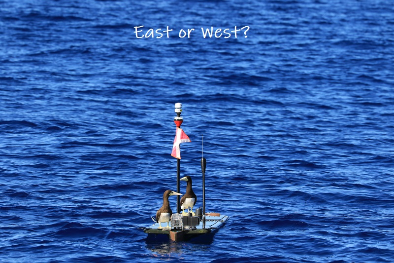
Aloha,
It has certainly been a very trying year for us all. However, to top it off for Jupiter, the results of our HUMPACS West mission has been published in Marine Mammal Science. The full article can be viewed here. Enjoy!
HAPPY NEW YEAR!

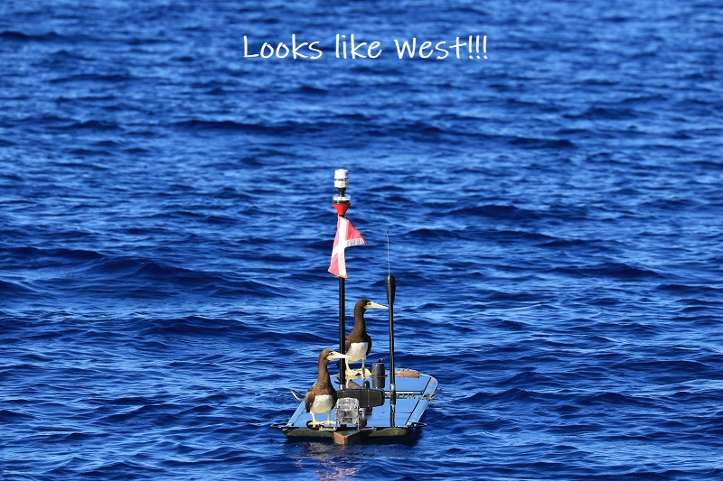
Aloha,
It has certainly been a very trying year for us all. However, to top it off for Jupiter, the results of our HUMPACS West mission has been published in Marine Mammal Science. The full article can be viewed here. Enjoy!
HAPPY NEW YEAR!
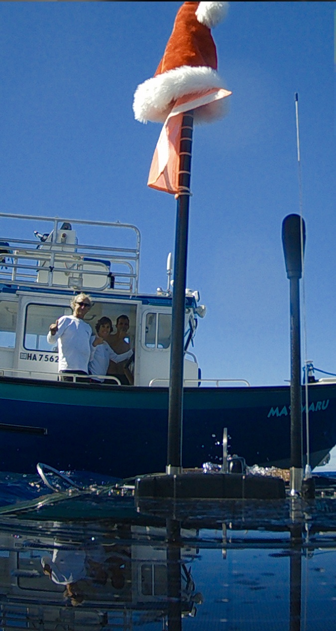
We know you’ve all been waiting anxiously to see the photos from Europa from the last few months, as well as the journey from Majuro, Marshall Islands, 650nm north to recovery her out in the middle of the Pacific. This could not have been done without the Indies Surveyor!
Well, the wait is over!
We’d like to make sure and thank EVERYONE that was involved in the recovery effort. There are so many people that lent a hand when we needed it, and we truly appreciate it.
Enjoy,
After 14 days of travel and adventure, we’re happy to say that Beth and Murray have touched ground back on the Big Island!
They successfully recovered Europa and all of the valuable scientific data that was collected on the mission. They then cleaned, disassembled, and packed up Europa in her entirety and shipped her home. She is expected to arrive on the Big Island within the next day or two.
For now, we are beginning to analyze the acoustic data. This is a pretty long and tedious task, but extremely valuable and necessary.
We have lots of video and pictures documenting the trip, and will post some of them in later updates.
Until then, check it out…we made the Marshall Islands newspaper!
Aloha!
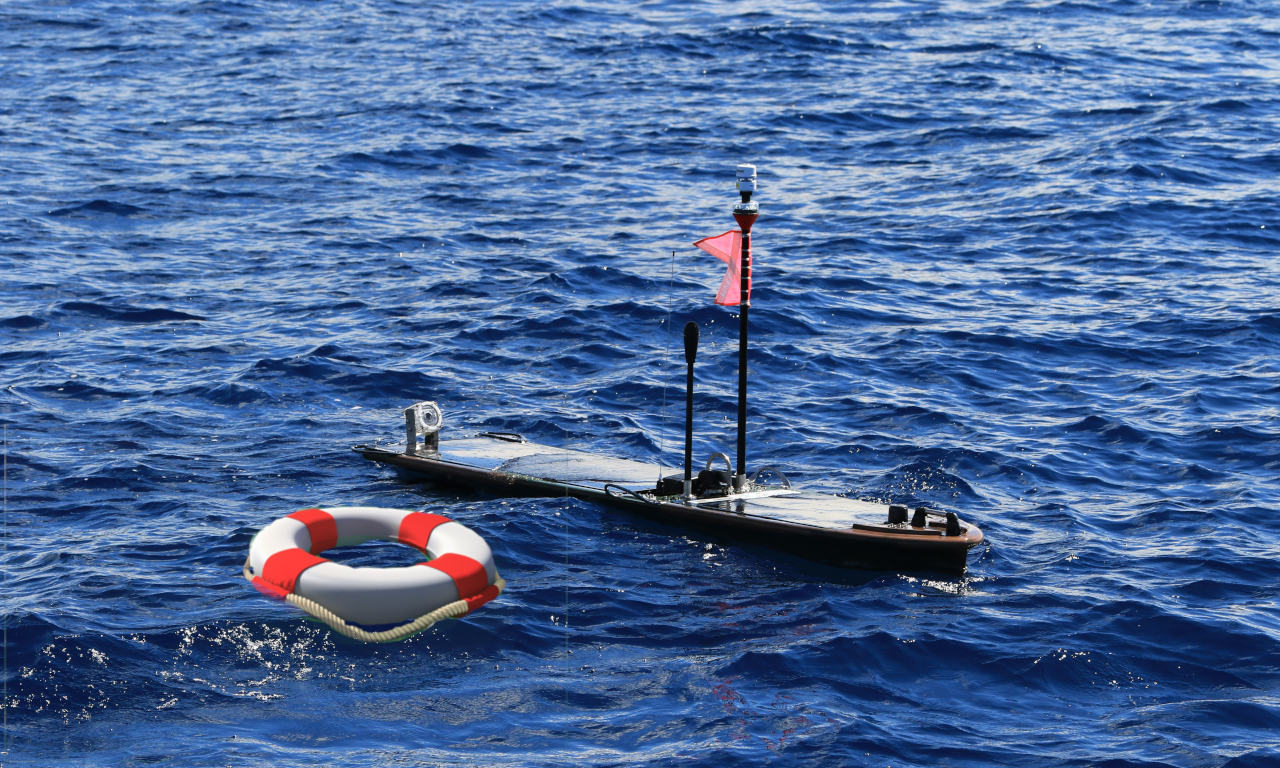
We just wanted to let everyone know that Europa was successfully recovered about 650nm north of the Marshall Islands on Friday afternoon.
Beth, Murray, and crew got Europa on board safely and without doing any damage to the glider. They’ve already began pulling off data and trying to diagnose what went wrong.
We don’t know much yet, but we’ll keep you posted!
As always, feel free to follow along on the journey at the HUMPACS page.
Aloha!

Beth and crew after successfully recovering Europa 650nm north of the Marshall Islands
As you all know from our last couple of blog posts, we lost control of Europa’s rudder module back on February 11, 2019, and have been putting our efforts towards recovering her since then.
Weather, logistics, and plenty of other things have been roadblocks, but we are now happy to report that WE ARE ON OUR WAY!
This last Sunday, two members from our Hawaii team, Beth and Murray, started the journey to the Marshall Islands, and are now on a boat heading out into the deep blue sea to find and recover Europa. They are currently experiencing 22kt winds and 8-10'+ swells.
Fingers are crossed for good weather and safe travels; and of coarse, a successful recovery.
If things stay on schedule, we’ll hope to report back that the rescue mission has been a success in just a few days. We’ll definitely keep you all posted, but if you’d like to follow along as Beth and Murray make way, check out our HUMPACS map. You can click on the boat icon and see the distance until they reach Europa.
Ok, that’s it for now. Safe travels Beth and Murray!
Aloha!
Not having control of the rudder module on Europa has really put the Jupiter team in a tough spot. We are completely at the mercy of the sea. For the past month we’ve continued to put our efforts towards recovering Europa, but we’re not there just yet.
In the mean time, we can still learn some things!

Like we mentioned in our last post, when we lost communication to the sub, the rudder automatically set itself in a “right rudder” position. Again, the goal is that it will do circles and stay in the same spot until it can either be fixed or recovered.
The ocean currents, however, have different plans!
If you’ve been following Europa you’ve noticed that it definitely hasn’t stayed in the same place. The currents are very strong out there in the middle of the Pacific Ocean, and even though Europa’s “right rudder” may slow things down, it’s not stopping the inevitable drifting to wherever the sea may take it.

The last 30 days of Europa’s travel, all of which it has been drifting with the ocean currents.

Left: Zoomed in portion of the 30 day picture
Right: Even more zoomed in portion, representing about 2 days of drift
As you can see, Europa is all over the place!
When we look a little closer, you get a really good idea of what’s happening out there. Currents can (and do) change all the time. For example, there might be a strong SW current in a location at noon, and then by 4pm it’s turned into a mild NW current.
Wind is the main contributor to surface ocean currents (the top 100m of the ocean). In the Northern Hemisphere, the winds basically circle in a clockwise motion. From East to West near the equator, and then from West to East up North. This helps to explain why Europa is drifting in a SW direction.
Actually, part of the reason we haven’t been able to recover Europa yet is due to the strong winds in the surrounding area.
If you have a look below, you can see the wind reports at, and around, Europa’s position. Remember, these are satellite projections. Europa is our real-time true report.
And here is a look at the currents (these are interactive widgets, so feel free to zoom and pan around)…
Depending on how much you zoom in, you can see the little areas where the currents just go in circles (aka gyres). In other areas there are just steady streams that basically go in one direction.
Europa has found itself in both of these throughout the last month, but, again, has mostly followed a SW path.
This is a unique, and unintentional, experiment where we get to monitor the ocean currents first hand out in the middle of the Pacific Ocean. It’s pretty cool to compare to these satellite projections and see how accurate they actually are.

Europa’s location, relative to the entire Pacific Ocean.
Well, we are still working to put together a recovery of Europa. Plans are in place, we are just waiting on a good break in the weather to go out an get it.
Our main hopes are that we keep communications to the float, and that it doesn’t get hit by some debris or a boat passing by. We’ve had some close calls, but so far so good!
We will keep you all updated and “current” (pun intended) as to what’s happening, and, as always, feel free to keep an eye on Europa from our HUMPACS page.
Aloha!
If you’ve been following Europa’s journey west, you probably noticed a very distinct change in it’s behavior on February 11th, 2019 (about 9 days ago).

This was not a planned detour.
Unfortunately, all communication to the the sub has been lost. We can no longer control the rudder, and that means Europa is currently just drifting with the ocean’s currents.
We are not sure what exactly caused this communication failure, but we took all possible steps to fix it remotely and found no success.
When the sub loses communication, it automatically gives itself a “right rudder”. This is for situations like the one we are currently in, and the hope is that the glider will just circle in the area where it lost communication until it can be fixed or recovered.
Being that the glider is out in the middle of the Pacific Ocean, there are a lot of strong currents that are pushing the glider in certain directions. When the sub is trying to do one thing, and the float another, twists in the umbilical can occur.
One twist means that the float has become 360 degrees out of sync with the sub. As you can see in the images below, Europa has had a number of twists take place since this communication error took place.

Europa at the beginning of the “right rudder” on February 11, 2019

Europa after a few days of drifting with the “right rudder”
Obviously, our plans have now changed! We need to find a way to recover the glider.
There are actually a number of foreign fishing boats out in the vicinity, but that proves slightly difficult for a number of reasons. Language, when they will go back to port, ability to recovery the glider, willingness to help. These are all factors in this recovery that we are currently dealing with.
Other options are also available in the Marshall Islands (currently about 700 nautical miles SSW of Europa), but they have their own issues as well.
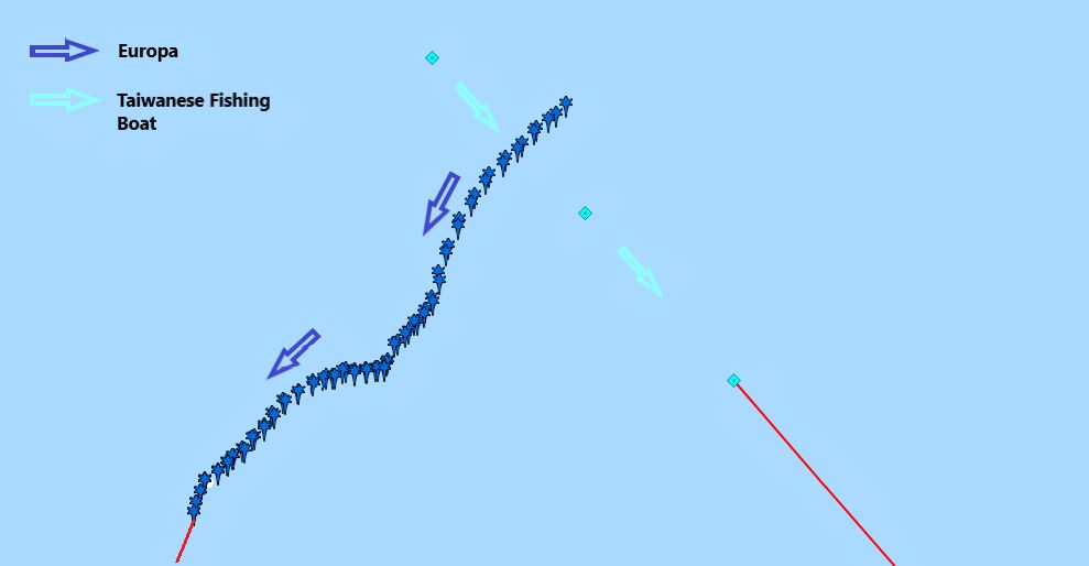
The above shows the path of a Taiwanese fishing boat, and how it missed direct contact with Europa by only 2.5 hours. The distance from the point where the two paths intersect to where Europa is currently at in this image is only 1 nautical mile. Unfortunately, due to communication issues, we were not able to contact the ship and have them try to recover Europa for us.
Of note: Europa will typically automatically avoid vessels that it determines are in its path within a certain distance. Because of the fact that the float cannot communicate with the sub, this functionality is now basically inoperable. This puts Europa at a higher risk of being run over by a boat while drifting at sea, hence, we are trying to recover sooner rather than later. In the mean time, we are requesting audio files that are stored on board in 30 second clips through Rudics in hopes to salvage as much data as possible in the event that we eventually lose Europa to a collision.
There are a few really good things that we still have going for us. We have full communication to the float. The sub is still attached. The cameras and lights and sensors on the float are still working.

These are all things that we’re actually very happy about. We are able to keep an up-to-date location on Europa, and expect that’s going to be a vital part of the recovery once we get a plan in place.
We are constantly working on a way to get Europa back, and will keep you updated along the journey.
As always, you can continue to track Europa along the way, and if you have any information or thoughts as to how to help aide in the recovery, we’d love to hear them.
Please feel free to reach out! We are offering a reward for the recovery of Europa.
Please contact admin@jupiterfoundation.org
Mahalo, and aloha!
You may have noticed that Europa has been bouncing around a bit more than it did on HUMPACS East. Well don’t worry…it’s intentional!
The general path that Europa is following goes along 20oN latitude.
The reason that it is not going in a straight line is because there are numerous seamounts and guyots (aka tablemounts) that we are having it navigate over on it’s way to the Mariana Trench.
Seamounts are basically underwater mountains that are at least 1,000m tall. They do not actually reach the ocean’s surface. Guyots are seamounts that did, at one time, rise above the ocean’s surface, but then eroded away, flattened out, and eventually sunk back down underwater.
Why does all of this matter?
Well, since Europa is basically a very small fish in a very big pond, we need to strategically look for these humpback whales. Even though most of the time the tops of these seamounts and guyots can be found many hundreds, if not thousands, of meters below the ocean’s surface, they are actually great producers of marine ecosystems. That makes us think that we might have a better shot at stumbling upon some humpbacks in those areas, as opposed to simply out in the middle of an even deeper ocean.
There has been some research to support the statement that humpbacks seem to frequent seamounts and guyots, though the exact reason why hasn’t been determined.
The leading theories are that the landmarks serve as resting and/or feeding areas, points for navigation, and even meeting grounds (source: PubMed Central®).
Maybe they’re sharing different versions of their song? At the end of the day, we don’t really know why…yet!
If you’d like to dive a little deeper into the science and evolution of a seamount, check out our blog post Mountains in the Deep Sea.
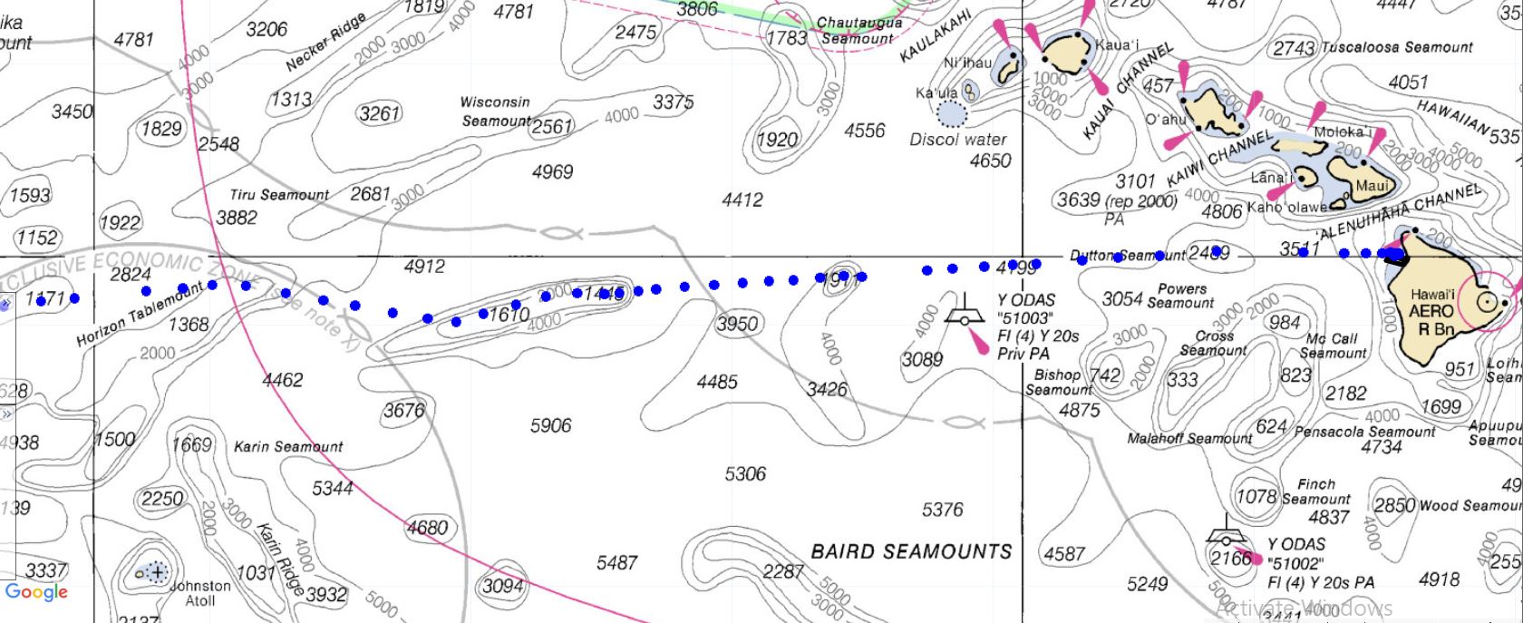
Figure 1: Europa’s path on a nautical chart. Europa is currently traveling from East to West, and navigating over many different seamounts and guyots. (Depths are in meters).

Figure 2: Zoomed in image to show more detailed depths of the Horizon Tablemount that Europa traveled over Jan 16-19, 2019.

Figure 3: Europa circling a particular seamount. We will have Europa do this from time to time to search a little more for humpbacks in areas we suspect them to be.
If you check out the HUMPACS page, you’ll notice that from January 16-19 Europa was cruising over the Horizon Tablemount. In another two or three weeks, Europa should be traveling around the HIG Guyot. This particular guyot is of note to us here in Hawaii because it was actually discovered about 37 years ago by the “Kana Keoki” research vessel, and named after the Hawaiian Institute of Geophysics (source: Marineregions.org).
So, for those of you that were wondering, and dare we say concerned, about Europa’s up and down path…worry no more! Europa is doing exactly what we want it to do, and we’re collecting lots of great data that we look forward to sharing later on.
Until then, keep checking in and watching Europa as it makes it’s way West across the Pacific Ocean.
Also, check out our live audio stream of the humpback whales that are swimming around Puako, HI right now!
Aloha!
When we were preparing for the first leg of HUMPACS, referred to as HUMPACS East, we found ourselves faced with a tough decision when it came to how the hydrophone should be mounted.
“Do we hang the hydrophone, or try to hard mount it as close to the sub as possible?”
When doing hydrophone operations just outside of Puako, Hawaii, we have found that you get the best audio if you hang the hydrophone at least 30 feet below the sub. This, obviously, is due to the fact that we’re basically decoupling the hydrophone from the sub. We also are able to pick up more sounds when we’re deeper.
Hearing that, you might wonder why we decided to hard mount the hydrophone during HUMPACS East.
Well, what we have also learned through years of experience monitoring the gliders off the coast of the Big Island is that when we have a hydrophone hanging, ocean currents become a much larger problem.
There are different currents at different depths, and so even though the glider (float, sub and hydrophone) are all relatively in vertical alignment, each part of them is getting pushed and pulled by a different current.
In Hawaii, it’s not that big of a deal for us because we keep the gliders in a relatively small area the majority of the time, and we can go rescue the glider if we really need to.
When sending it across the Pacific Ocean, it’s a different story. There are no rescue missions. It just has to work!
For that reason, we decided to keep the hydrophone hard mounted directly to the sub, with no separation or “acoustic isolation”. We knew that the background noise (flow noise, wing springs and rudder) would be very loud. However, we confirmed that even with all this loud background noise we would be able to detect humpback whales, as we did a proof of concept with humpbacks singing off Puako before sending it east. All this was worth it to know that the hydrophone would be very safe. After all, we’d never made this trek before, (no one had for that matter), so we didn’t know what kind of abuse it might encounter. Sharks, rubbish, wear and tear, getting tangled up by the umbilical. These were all big concerns, and, at the time, we needed to play it as safe as possible.

HUMPACS East
Copper Hydrophone Mount
All these concerns continued to stand true with HUMPACS West. We still agreed that the unknowns about drifting were too much of a risk, so we mounted it close, but not hard mounted.
Since we did not encounter any drift that could have entangled the hydrophone, nor any shark bites, for HUMPACS West, we decided to see what the minimum distance was that we could drop the hydrophone and achieve higher quality audio. We still needed to keep the hydrophone safe, but we wanted more vibration isolation between the sub and the hydrophone itself.
After testing many different materials and changing up the distance of which we dropped the hydrophone below the sub we came to the conclusion that a three inch drop using EPDM Fiberglass Reinforced rubber sheets to mount was the way to go. It improved our audio and also kept the hydrophone safe at the same time. As an additional safety measure, we added a deflector bar to the bottom of the sub to help prevent shark bites and entanglement on the hydrophone.

HUMPACS West
EPDM Fiberglass Reinforced Hydrophone Mount
Take a look at the two spectrograms below and see the difference in noise levels. HUMPACS West is exponentially more quiet than HUMPACS East. There is also almost a complete elimination of the 650Hz and 975Hz harmonics from the rudder module. This, alone, is a very improved piece of the puzzle, as the primary range that we listen and view the humpbacks’ song is in that <1KHz range.

HUMPACS West Spectrogram

HUMPACS East Spectrogram
As you can see, HUMPACS West is much more quiet as far as background noise goes. What’s that do for us? Well, if the background noise is less, then it becomes substantially easier to detect humpback whales (and other species). This improvement should greatly improve our post processing efforts, and is more efficient at detecting as many humpbacks as possible.
Currently, Europa is a little over 700nm (nautical miles) west of the Big Island of Hawaii. Follow its journey on the HUMPACS page!
Aloha!
Europa is back in the water on her second mission to listen for humpback whales, just in time for the Holidays. Last year, Europa successfully completed the East Leg (from Hawaii to the Baja California Seamount Province and back), and now she will swim to the Mariana Trench and back (the West Leg). Biologists have wondered if there is an undiscovered distribution of humpback whales among the seamounts between these areas. Since the East Leg was successful, we hope Europa’s journey west will be triumphant. You can track Europa’s path on our website. Stay tuned for more updates!
Wishing you a Happy Holiday and a Joyful New Year!
© 2013-2023 Jupiter Research Foundation. All rights reserved. | Privacy Policy