HUMPACS East

End of year...

Our HUMPACS project has made for an exciting and busy year. To wrap it up, Beth had the opportunity to present the results of our HUMPACS East mission at the World Marine Mammal Conference in Barcelona, Spain Dec 6-12, 2019. She presented in the session on “Assessing Marine Mammals in the High Seas” as well as in the workshop “Using smart acoustic technology to detect, classify, localize and track marine species”.

Beth presenting at the WMMC

Beth presenting at the WMMC

Beth Goodwin, Rose Fisher, Jillian Duggan, Ashley Noseworthy (left to right)

Beth Goodwin, Rose Fisher, Jillian Duggan, Ashley Noseworthy (left to right)

We have another HUMPACS mission planned for 2020! Check back in with us in January, in the mean time wishing you all a Joyful Holiday and a Happy New Year!!


For a look back at Europa's prior journeys, check out our MAP and the Sea Surface Temperature (SST).

Aloha!

Subscribe to our blog

For Immediate Release:

Ed Lyman-HIHWNMS-NOAA Fisheries Permit #782-1719 (Original image has been altered to include Wave Glider) - Copy1.png


Autonomous (Robotic) Wave Glider Mission from Hawaii to Mexico Detects Humpback Whale Calls in Tropical Mid-Ocean and Questions Definition of Winter Breeding Assemblies 

Current NMFS humpback whale management policies assume Mexico and Hawaii winter assemblies are distinct with separate status and management warranted


BIG ISLAND, HAWAII July 1, 2019 – Jupiter Research Foundation and Whale Trust are pleased to announce the publication of the results of the first leg of their autonomous Wave Glider HUMPACS (Humpback Pacific Survey) acoustic survey in Journal of the Acoustic Society of America – Express Letters. During a 100-day nearly 7,000 km (3,800 nm) round trip survey on a line between Hawaii and Mexico within the 2018 winter breeding season, humpback whale calls were heard in mid-ocean basin, halfway between the known near-shore assemblies. 

“They’re not ‘supposed’ to be there,” says Dr. Jim Darling, Whale Trust biologist and project partner. Humpbacks are known to assemble in specific near-shore, relatively shallow, breeding grounds in Mexico and Hawaii. “But then no one has looked in these more remote, offshore areas either.”

Mission control was from Puako, Hawaii where Beth Goodwin, Jupiter Research Foundation VP and HUMPACS Project Manager, and her team were in daily communication with the Wave Glider: monitoring status, downloading surface and underwater photographs, downloading short samples of recordings via satellite, and making course alterations if needed. 

From January 16 to April 25, 2018, the Wave Glider, named Europa (after one of Jupiter’s moons), performed a 6,965.5 km, 100-day (RT) continual acoustic survey from Hawaii towards Mexico circa 20° N. The survey resulted in 2,272 hours of recordings and included over 4,000 cetacean calls.  Of these calls, 2,048 were identified as humpback whale calls.

The humpback calls were recorded up to 2,184 km (1179 nm) offshore spanning 30 days between January 20, when the Wave Glider left Hawaii, to February 23, 2018. On many days, multiple humpback call detections were recorded (up to 377 calls over 23 hours of a day). Actual numbers of whales cannot be determined, as one whale can make many calls.

“This was risky, we had no idea if humpbacks were even out there,” says Goodwin. “And then, even if they were, there were needle-in-haystack odds of intersecting them considering the size of the Wave Glider and the size of the ocean.”

Possible explanations, suggests Darling, include an undocumented migration route to Hawaii, a separate (from Hawaii and Mexico) offshore assembly of humpback whales, or travel between Mexico and Hawaii assemblies within the same season. At the very least, these results indicate an extension of winter distribution and habitat of humpbacks. It could also be that these offshore whales have not been included in current population estimates.

Since 2016, the model used by the U.S. National Marine Fisheries Service (NMFS) to manage humpback whale populations has treated the Mexico and Hawaii winter assemblies of humpback whales as distinct populations. As such, these populations have different status under the U.S. Endangered Species Act (ESA): Mexico humpback whales are considered threatened while Hawaii humpback whales have been delisted; that is, the Hawaii population has no protection under the ESA.

This assessment is further complicated by longstanding research showing shared song between the breeding assemblies and an interchange of photo-identified individual whales between these two winter breeding grounds.

Our findings question the independence of Mexico and Hawaii humpback whale populations and illustrate the huge potential for the use of autonomous vehicles in the study of whales across remote locations of the ocean.

“We feel certain our results will encourage more research, affect how humpback and other whales are monitored, and help with management,” says Goodwin.

The paper is online: https://doi.org/10.1121/1.5111970


BACKGROUND


Wave Glider

The Wave Glider (produced by Liquid Robotics, a Boeing Company) consists of a surfboard-sized surface platform (the float) tethered by an umbilical cable to a submerged glider (the sub) 8 m (26 ft.) below the surface. The float includes a command and control unit, three solar panels, an instrument package, surface and underwater cameras and communications systems. The sub is the propulsion unit, which transforms vertical wave movement into forward motion (https://www.liquid-robotics.com/wave-glider/how-it-works/). Time-lapse series of images from the two Europa cameras, surface and underwater, are accessible on the JRF blog:
http://jupiterfoundation.org/current/2018/5/22/f2l6bevguh177l21x42gi20pegicbv

About Jupiter Research Foundation

The Jupiter Research Foundation is a 501(c)(3) non-profit scientific research organization. Established in 2003, the Foundation is dedicated to conducting innovative scientific research and finding technological solutions to problems which are outside of mainstream science and technology. Our findings are shared with the public and academic community in hopes of better monitoring and understanding the natural world. Visit https://jupiterfoundation.org/ to learn more. 

About Whale Trust

Whale Trust is a Maui-based 501(c)(3) non-profit organization whose mission is to promote, support and conduct scientific research on whales and the marine environment and broadly communicate the findings to the public. Whale Trust research programs focus on behavior, communication and social organization of whales. For more information, visit https://whaletrust.org/.


For a look back at Europa's prior journeys, check out our MAP and the Sea Surface Temperature (SST).

Aloha!

Subscribe to our blog

HUMPACS East Results Are In!

We know you’ve all been waiting to hear about the success of HUMPACS East, and believe us, we’ve been just as anxious to let you all know.

Our results have just been published in the The Journal of the Acoustical Society of Amer (Vol.145, No.6).

The purpose of this study was to investigate if whales were present in the offshore waters between the Hawaii and Mexico breeding grounds where, to our knowledge, they have never been documented before. It’s a big ocean out there, so we were searching for a needle in a haystack…and we were successful!

Publication East Map.jpg

We identified humpback calls out to 1,200nm from Hawaii, approximately midway to Mexico.

Our findings raise more questions regarding humpback whale breeding grounds, migration routes, and habitat. We have presented our results to the Marine Mammal Commission and hope to present at the World Marine Mammal Science Conference in Barcelona, December, 2019. We feel certain our results will elicit more research, affect how marine mammals are monitored and help with management.

Read the Publication (link to PDF)

Supplemental Material (link to download)

Copyright 2019 Acoustical Society of America. This article may be downloaded for personal use only. Any other use requires prior permission of the author and the Acoustical Society of America. The article appeared in The Journal of the Acoustical Society of Amer (Vol.145, No.6) and may be found at https://doi.org/10.1121/1.5111970.

Below is a short annotated power point presentation of our mission and results.

Aloha!


For a look back at Europa's prior journeys, check out our MAP and the Sea Surface Temperature (SST).

Aloha!

Subscribe to our blog

Photo Time-lapses from Europa

Almost one month has passed since we recovered Europa, and we are still in the process of analyzing data, however; we have reviewed all of our photos. During the 3.5 month mission, we had a camera attached to both the top and bottom of Europa’s float that took above and underwater images periodically on a daily basis.

The top camera was mounted on the back of the float looking forward, which enabled us to inspect the float and antenna deck during the mission. The bottom camera looked down towards the sub underneath the water to help us check the sub and umbilical. In the previous blog, we mentioned we had a gooseneck barnacle that grew over the underwater camera lens. Even so, we were still able to get glimpses of the sub for diagnostic purposes.

Over the 3.5 month mission, the top and bottom mounted cameras took over 500 photos each. We have constructed two time-lapse videos of the above and underwater pictures, which are each a little over three minutes long. We were able to capture some fantastic photos! The sunset photos and waves washing over the float are captivating, and it’s fun to watch the barnacle grow over time in the underwater footage.

In our next blog, we will post some sample of audio files of some exciting sounds we’ve heard, including odontocetes whistles and clicks, echolocation, and other unusual noises. Stay tuned!


For a look back at Europa's prior journeys, check out our MAP and the Sea Surface Temperature (SST).

Aloha!

Subscribe to our blog

Europa is Home!

After many late nights and early morning of monitoring Europa, she was finally close to home. Europa endured many challenges during the 3.5-month mission, from huge waves, high winds, strong currents, sharks, marine debris, to near collisions with large ships! We are very proud of her!

On April 24th, she rounded South Point and started veering north as she fought powerful south-bound currents. The currents had her barely creeping, so at daybreak on the 25th, our team loaded our vessel, the May Maru, with recovery gear, and trailered the boat to launch from Honokohau Harbor in Kona. We found Europa just south of Milolii, about five miles off the coast.The retrieval mission was about 90 miles round trip and took about four hours, an effort well spent.

In this video we were approaching Europa just south of Milolii,

Here we were pulling Europa up onto our boat with the davit.

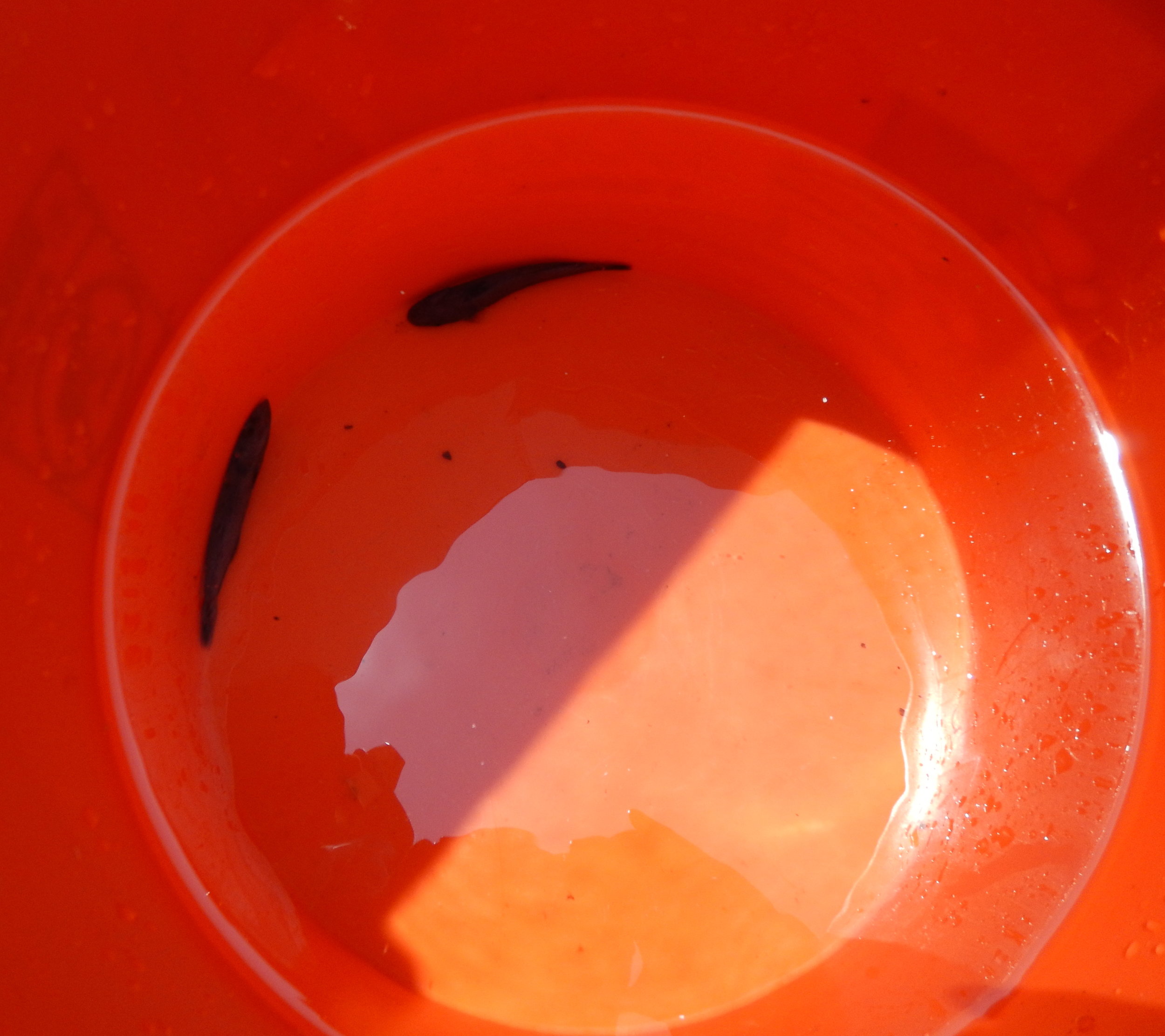
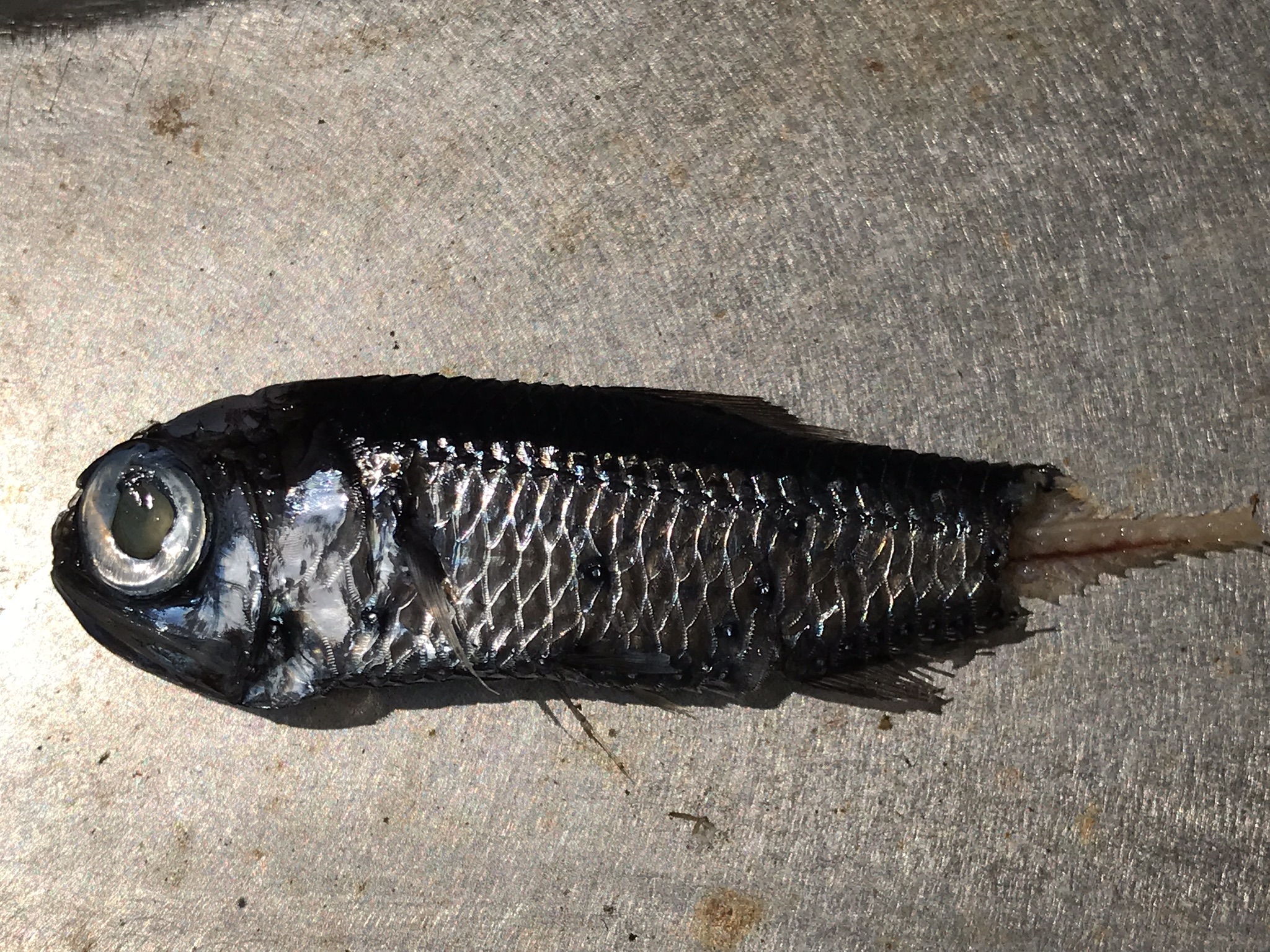
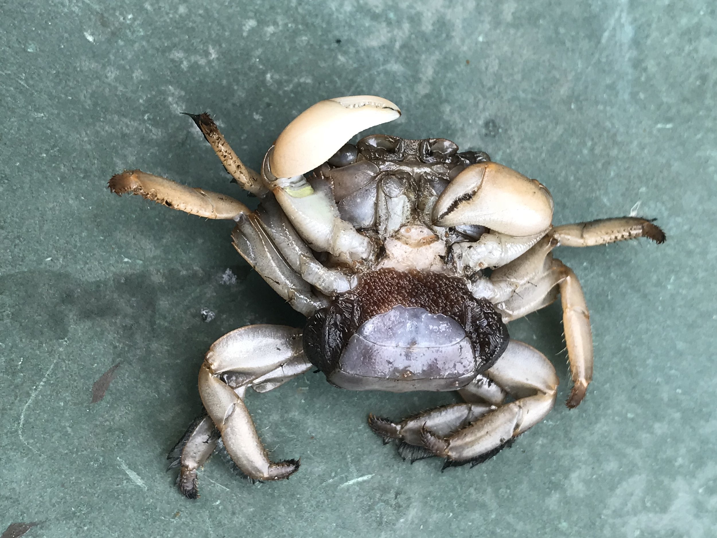
Once we got her on the deck, we visually inspected her for any damages and documented all of the critters that had hitched a ride, such as barnacles, crabs, and fishes. We then secured her to the deck and brought her home. The following day, we disassembled and examined all the payloads, and continued to document, and then identify, the marine organisms and debris that lingered in the payload bays. Overall, everything was in good shape, and the biofoul was minimal.

We are currently in the process of analyzing the temperature and salinity data from the HOBO logger that was attached to the bottom of the float. We have over 800 above and underwater pictures to download. Also, we are preparing to investigate our 2,000+ hours of acoustic data. We will, therefore, be hard at work for the next few months. After our analysis, we’ll publish our results in a peer-reviewed Journal and on our website. Stay tuned for updates within the following months, and thank you for following our HUMPACS mission. We can’t wait to see what will be revealed!


For a look back at Europa's prior journeys, check out our MAP and the Sea Surface Temperature (SST).

Aloha!

Subscribe to our blog

Land Ho!

Europa approximately 40 nautical miles off South Point (the red star).

Europa approximately 40 nautical miles off South Point (the red star).

Europa is nearing the shores of Ka Lae (ka-lie), or South Point, which is the southernmost tip of the Big Island and the United States. Archaeological excavations and Hawaiian tradition indicate Ka Lae, meaning “the point,” was the first place the early Polynesians occupied in Hawaii, as early as A.D. 124. The area is an official National Historic Landmark (NHL) because of its cultural significance and importance. Claiming this region as an NHL enables protection and preservation under the National Historic Preservation Act (NHPA).

Two prevailing currents converge off the coast of South Point: Kāwili and Hala’ea.The Kāwili, or the Hawaiian Lee Counter Current, flows from west to east all the way from Asia. This current is thought to have helped early Polynesians find the Hawaiian Islands while traveling from their original homeland: Kahiki.

The Hala’ea, also known as the North Equatorial Current, travels east to west by trade winds and is named after the greedy chief, Hala’ea. Oral histories and texts say Hala’ea ordered his men to throw all of their aku (tuna) into his canoe so he could claim all of the fish for himself. His men threw so many fish into his boat that it capsized, and he was swept out to sea by a strong current. Hence, the current bears his name.

The currents bring many nutrients and make the waters off Ka Lae abundant in fish. However, they also carry a vast amount of trash that piles up along the coastline. The majority of the waste is plastic, likely from the Great Pacific Garbage Patch carried by Hala’ea.

Since the first settlement of Polynesians, communities within Ka Lae have relied on fish as their prominent resource. In the 1950s, the University of Hawaii and the Bishop Museum excavated a site called Pu’u Ali’i. This location is thought to be one of the first dwellings in Ka Lae established by fishermen. Archaeologists found many different types of large fish hooks and tools to make them, including coral and stone abraders. Further excavations in Ka Lae revealed a fishing shrine (Ko’a) within the Kalalea Heiau. This shrine was created for the fishing god, Ku’ula, to maintain the abundance of fish. Other remaining cultural sites within the area are Lua o Palahemo, the Canoe Mooring Holes, and Lua Makalei.

The federal government manages NHL’s, and although it protects Ka Lae, it does not provide enough support on a local and state level. As environmental and cultural regimes continue to shift in Hawaii, significant stakeholders of Ka Lae (community members, the State of Hawaii, and the Department of Hawaiian Homelands) have recognized the need for additional preservation, conservation, and management efforts. Thus, since 2016, a new management plan has been underway that implements community-based management strategies of long-term land stewardship, and natural resource and cultural management.

Europa was able to swim past South Point without any issues from the currents as she traveled towards Mexico. We hope she doesn’t have any trouble as she passes it once more on her way home. Once she wraps around the point and gets north of Milolii (see map above), we plan to retrieve her with our vessel, the May Maru. She has approximately 80 nautical miles to go until retrieval. Track the rest of Europa's journey on our website and stay tuned for exciting new updates after HUMPACS concludes!


For a look back at Europa's prior journeys, check out our MAP and the Sea Surface Temperature (SST).

Aloha!

Subscribe to our blog

How the Sea Shapes our Lives

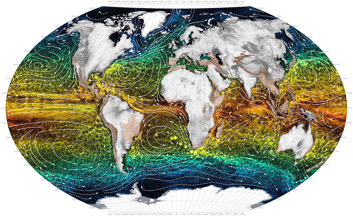
Ocean Currents. Photo by Atlas for the End of the World

Ocean Currents. Photo by Atlas for the End of the World

The vast, mysterious ocean, covering 71 percent of the Earth, plays an essential role in our everyday lives. Not just for the coastal and island dwellers, but for everyone. The ocean provides many ecosystem services, including food production, fisheries, pharmaceuticals, oxygen regulation, carbon storage and sequestering, water quality enhancement, coastal protection, biodiversity, economy, cultural values, and climate and weather regulation. Without the ocean, we would not be able to survive.

One of the most critical ecosystem services of the ocean is weather and climate regulation because it affects economies and livelihoods on a global scale. The sea has a low albedo, meaning it absorbs most of the sun’s heat radiation. Thus, water molecules heat up and evaporate into the atmosphere and create storms that are carried over long distances by trade winds and currents. These storms can become destructive as they accumulate warm water while traveling over the ocean.

Ocean currents are crucial for regulating the climate and transferring heat around the globe. Water density, winds, tides, and the earth’s rotation direct and power the currents, which are found on the ocean’s surface and at a depth below 900 feet. They move water horizontally and vertically and occur on a local and global scale. The currents create a global conveyor belt that acts as a global circulation system. It transfers warm water and precipitation from the equator towards the cold-watered poles and vice versa. It also plays a vital role in distributing nutrients across the ocean.

As seasons change, so do wind and weather trends, sea surface temperatures, and currents. Currents are stronger in the winter than they are in the summer because there are stronger winds and colder sea temperatures. Furthermore, spring is a considerable transition period. During this time, temperatures begin to warm, the density and salinity of the ocean changes, and wind patterns shift. These factors significantly influence currents, causing them to become unstable.

Without currents, the land wouldn’t be habitable because temperatures would be too extreme; the equator too hot and the poles too cold. Additionally, the precipitation distributed by currents and wind is necessary to all living things and is needed to sustain life. Foreseeable current, weather, and climate trends are key components in maintaining a healthy economy by supporting crops, livestock, tourism, etc., and can also save lives from dangerous storms and create more resilient communities.

Currents are measured and monitored by moored and drifting buoys that relay data via satellite. These buoys are efficient in collecting data, but they are quite costly and require much effort to deploy, retrieve, and maintain. Moored buoys often break from their mooring and can't be implemented in deep waters. Wave Gliders, however, can measure and monitor surface currents on a local and global scale in any seas without the considerable exertion and cost. Therefore, they could be utilized as an alternative to some of the moored buoys or drifters while collecting other vital data such as salinity, sea surface temp, CO2 levels, and much more. 

Europa has not experienced much trouble from the changing spring currents thus far. Although, on April 5th, she hit a robust northern current with no sea state to give her power, which made her veer off course a little. Fortunately, we were able to turn on the thruster (a small solar powered, electric propeller on the sub) that quickly put her back on track. We hope the currents remain steady and in our favor, so she’ll return home as soon as possible.


For a look back at Europa's prior journeys, check out our MAP and the Sea Surface Temperature (SST).

Aloha!

Subscribe to our blog

Oh Barnacles, those Crusty Foulers!

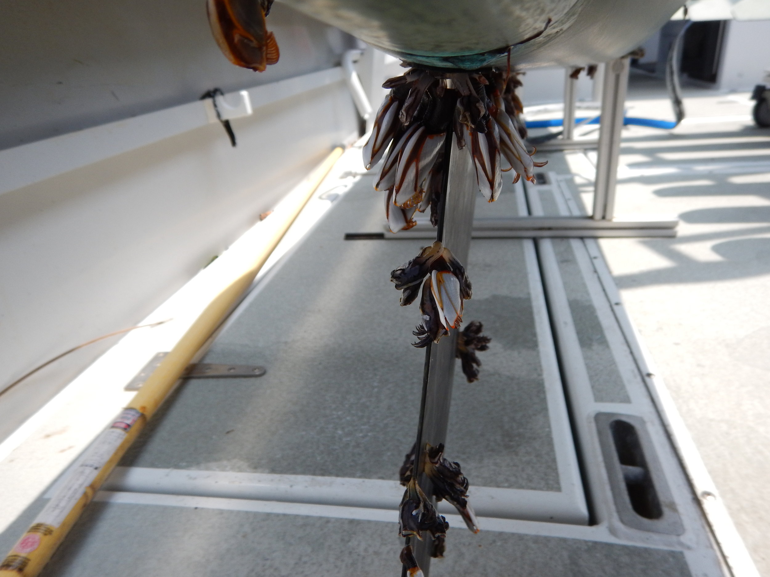
Barnacles are pesky little creatures. Have you ever heard of Barnacle Bill, the foulest sailor? Well, he’s named that for a reason. Sailors, shipowners, and mariners hate barnacles because they attach to the bottoms of boats and ships (biofouling). Large barnacle colonies weigh marine vessels down, which causes them to drag and burn more fuel. In our case, they stick to the bottom of our Wave Gliders and block the camera’s field of view.

Biofouling is a process where invertebrates, including barnacles, mussels, sponges, and corals stick to marine surfaces. For this to occur, a biofilm consisting of bacteria, algae, seaweed, or diatoms must first form on the substrate. The formation of biofilm is dependent on many environmental factors, however, once it develops, the biofoul rapidly increases.

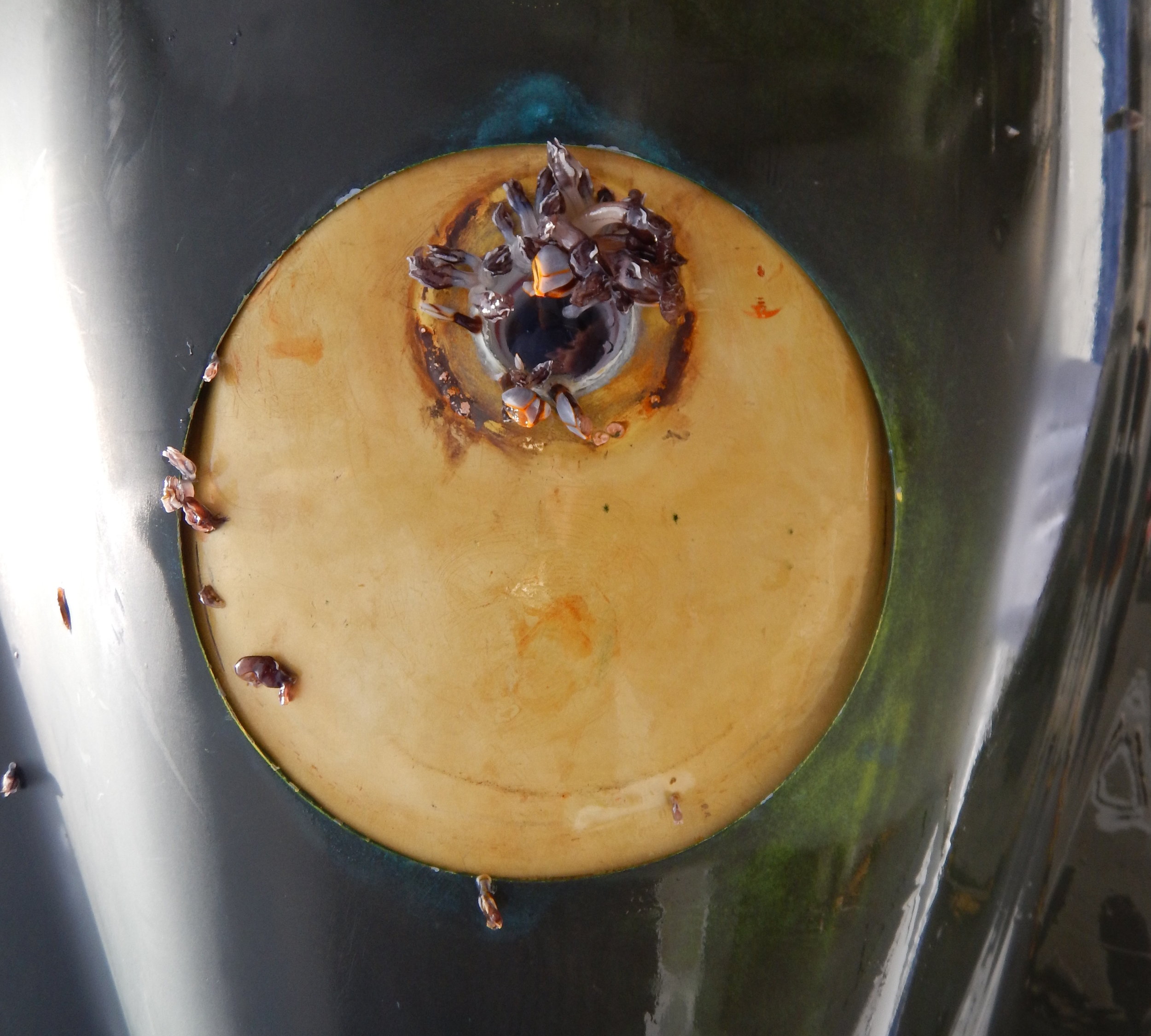
To prevent biofouling, we experimented with an antifouling Coppercoat™ paint and a 90-10 copper-nickel alloy before deploying Europa. First, we painted the entire vehicle with the Coppercoat™. If we didn’t do this step, a thick layer of barnacles and algae would encrust Europa and significantly weigh her down. We then sheathed the camera within a copper-nickel casing with an acrylic lens in hopes that biofouling would not occur.

This image displays the bottom of Europa's float, painted with a Coopercoat paint. The Camera (facing down) is encased in a copper-nickel alloy housing with an additional copper ring around the acrylic lens to prevent biofouling.

This image displays the bottom of Europa's float, painted with a Coopercoat paint. The Camera (facing down) is encased in a copper-nickel alloy housing with an additional copper ring around the acrylic lens to prevent biofouling.

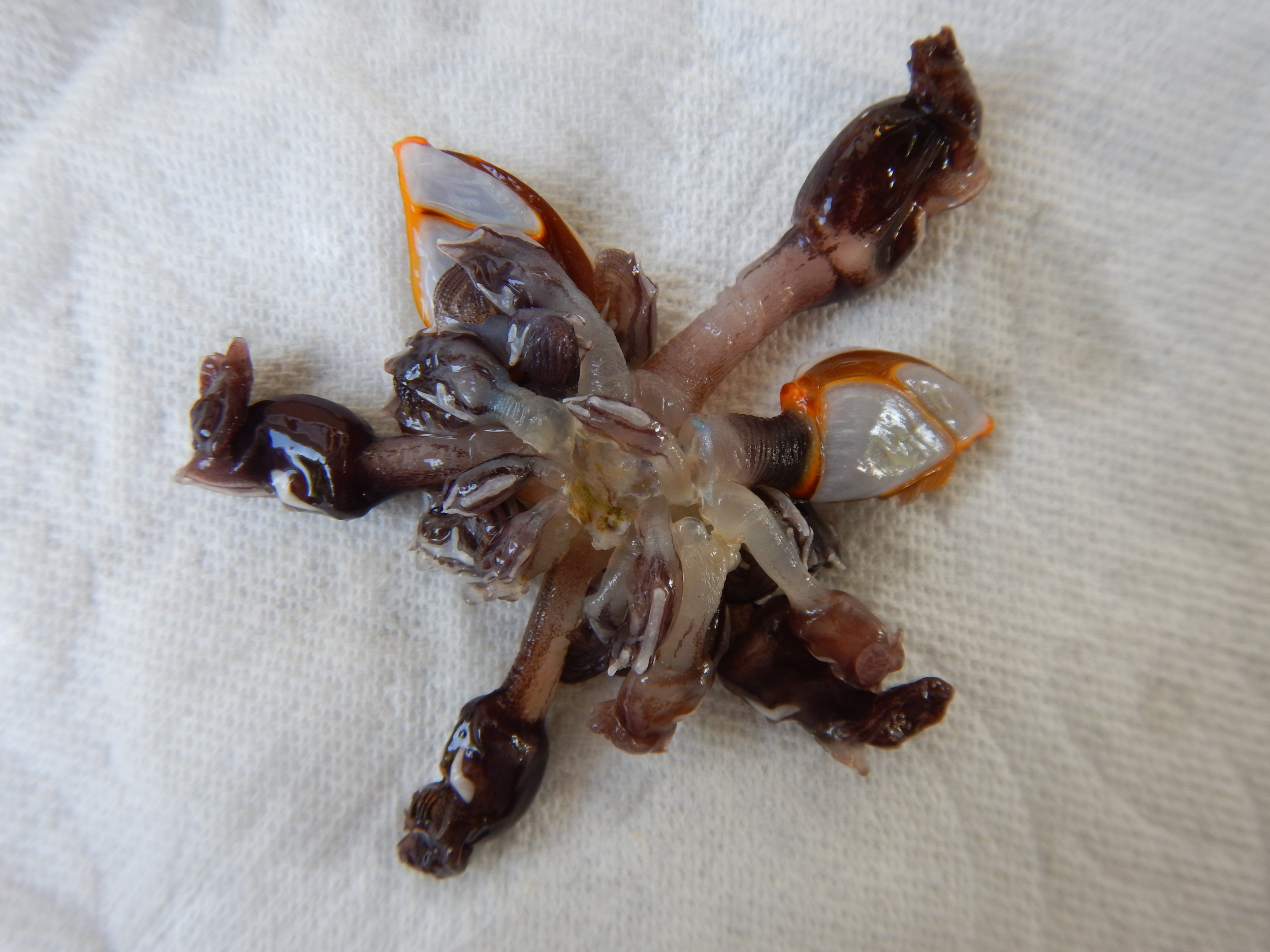
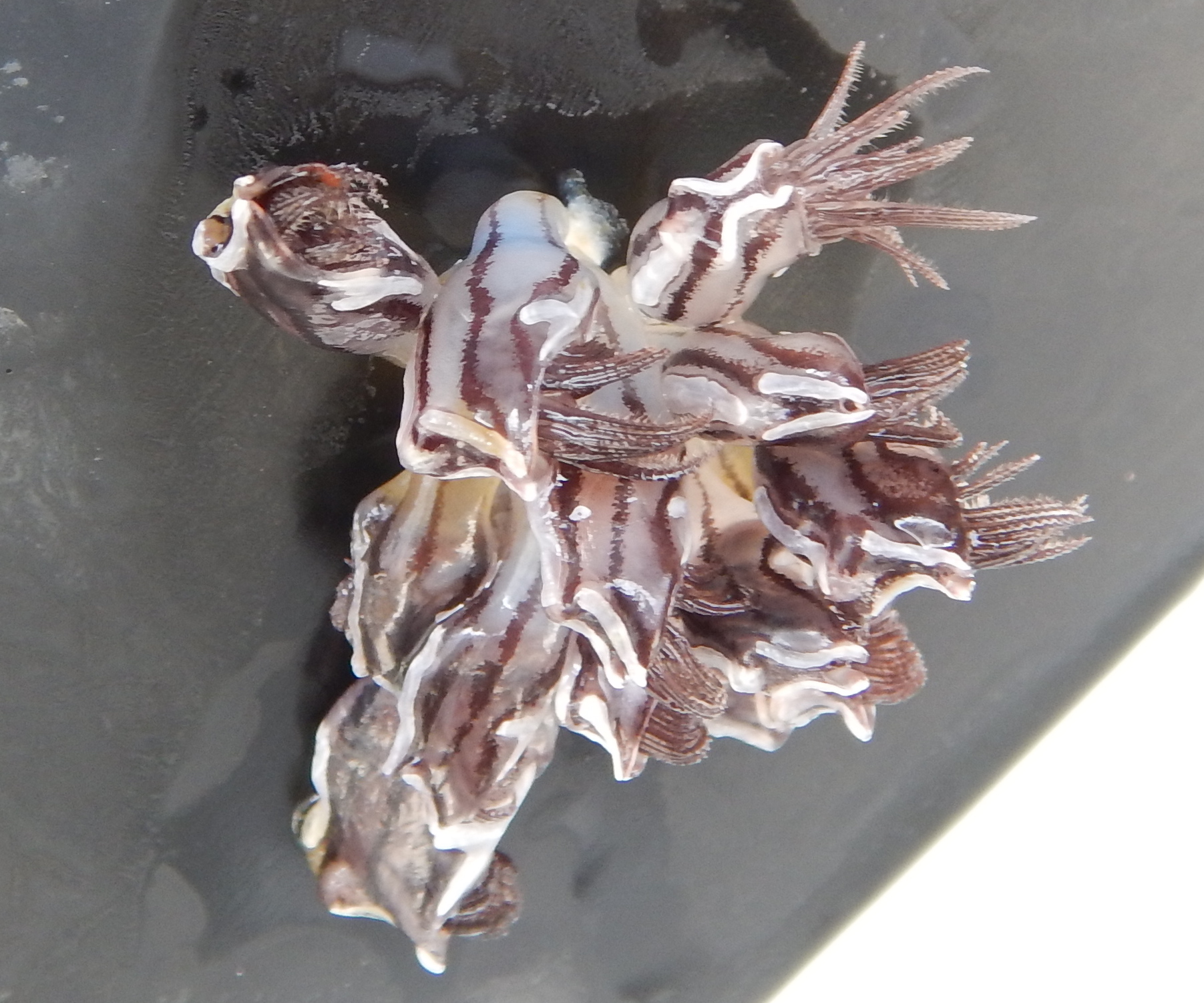
As a secondary safeguard, we incorporated an additional biofoul resistant copper ring around the lens. Unfortunately, that didn’t work as we’d hoped. Europa has had a barnacle progressively developing over the camera’s field of view for over a month, and there’s nothing we can do about it. Their lifespan is 8-20 years so that barnacle will keep growing until Europa’s mission is complete, at which time we will identify this barnacle. Below is an image sequence of the barnacle forming in the camera lens.

So, besides being annoying, what is a barnacle’s purpose and ecological role? Barnacles are in the Crustacea taxon, meaning they are related to shrimps, lobsters, and crabs. They are most abundant in areas where upwelling occurs, worldwide. As larvae, barnacles function as zooplankton; microscopic organisms that float around as food for other critters. As they morph into adulthood, they affix themselves to surfaces, such as rocks, ships or whales, and eat microscopic plankton through feather-like appendages called cirri. Primarily, they play a trophic role in balancing plankton populations.

Barnacles secrete a robust adhesive substance like super glue that has enormous medical and engineering potential.  Scientists have discovered barnacle’s glue binds the same way humans’ blood does when it clots. By researching it further, scholars can gain more information about how to prevent barnacles from fouling.


For a look back at Europa's prior journeys, check out our MAP and the Sea Surface Temperature (SST).

Aloha!

Subscribe to our blog

The White Shark Café

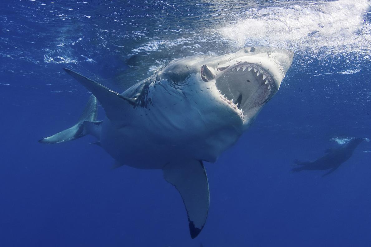
A great white shark. Image by Jim Abernethy, National Geographic.

A great white shark. Image by Jim Abernethy, National Geographic.

Great white sharks, a species over 16 million years old, are one of the most feared animals on Earth.They’re quite frightening; lurking in the ocean with their massive torpedo-like bodies, dagger-like teeth, and soulless, beady eyes. It’s safe to say the movie “Jaws,” is in part responsible for this fear. Let’s face it, they tend to get a bad rap, but sharks aren’t the mindless killing machines we perceive them to be.

Sharks play an essential role in the ocean’s ecosystem by keeping the food web in balance. They are top predators in the sea - a keystone species. Sharks maintain fish populations by eating them. Those fish then eat smaller fish, which eat even smaller fish, etc., all the way down the food chain. If sharks went extinct, the entire composition of the food web would shift and cause a top-down trophic cascade. The need for shark conservation has grown as the demand and exploitation rate of sharks have increased. Fishers kill millions of sharks every year for the Chinese delicacy: shark fin soup.

Every winter, in the North Pacific Basin, hundreds of great whites migrate from the California and Baja California coasts to a subtropical gyre, nicknamed the White Shark Café. This congregation area is located halfway between Hawaii and Baja California. Scientists are unsure why these sharks gather here. Maybe they’re socializing over a hot latte. More than likely, the sharks are meeting in this location to eat or mate.

At the Café, male sharks perform a strange, mysterious behavior of diving up and down continuously to approximately 150 ft. What is the purpose of this behavior? With the goal of gaining more knowledge, the Monterey Bay Aquarium Research Institute (MBARI) and other researchers are attaching camera tags to the sharks’ dorsals to record their diving conduct while they’re at the Café. MBARI has produced a neat video clip about the camera tags, available to view on YouTube.

On Feb 22nd, Europa started swimming through the southern outskirts of the Café, and she is still within the sharks’ migratory route. So far we’ve been fortunate a shark hasn’t chomped on her and obliterated all our data (keeping our fingers crossed)! Also, ship traffic has started increasing as Europa swims further into the Baja California Seamount Province (BCSP). All of this makes her more vulnerable and increases her risk.

Europa is currently surveying a few more seamounts in the BCSP. Then, she’ll start her trek home and continue to collect data. As she heads to Hawaii, we’ll want to keep her at low-risk by steering her south of the Café. Once we approach the Big Island where there’s more ship traffic, we’ll decide the best path into port to prevent a collision. So far, we’ve been able to steer away from any critical danger. We hope to keep it that way!


For a look back at Europa's prior journeys, check out our MAP and the Sea Surface Temperature (SST).

Aloha!

Subscribe to our blog

Mountains in the Deep Sea

A seamount is an underwater sea mountain formed by plate tectonics and volcanic activity. Seamounts form near the boundaries of tectonic plates and hotspots (Image 1). Plates force ocean and crust to descend towards Earth’s hot interior as they converge and collide near subduction zones. Here, the crust melts and forms into magma. The magma then returns to the surface as it buoyantly rises and fills in the gaps where plates diverge along mid-ocean ridges.

Image 1. This image from the Scientific Library Online displays a range of mapped seamounts. Scientists have only explored a small percent of these seamounts.

Image 1. This image from the Scientific Library Online displays a range of mapped seamounts. Scientists have only explored a small percent of these seamounts.

Earth’s crust is rich in silica. When it subsides, it makes the magma near subduction zones more viscous. Think of honey. Honey is extremely thick and sticky because it has a high silica content. The magma is also high in gases, including water vapor, and carbon and sulfur dioxide, that come from the ocean, soil, and rocks. Viscous substances don’t release gases quickly, so they accumulate in the magma chamber. As the gases increase, the pressure increases and magma explodes through the seafloor. The thick magma builds on the surface of the sea floor and cools rapidly, forming steep mounts. Isolated regions of magma called hotspots also create seamounts.

Seamounts are known to be diverse ecosystems. Vital nutrients are brought in by strong ocean currents and the process of upwelling (Image 2). Upwelling occurs when the wind blows across the ocean’s surface and pushes water away, allowing water to emerge from beneath the surface to replace it, along with nutrients from the deep, cold depths. The pressure of the ocean creates friction along the seamount walls, forcing the nutrients to rise through an eddy (Image 3).

Image 2. This image from NOAA demonstrates the process of upwelling.

Image 2. This image from NOAA demonstrates the process of upwelling.

Image 3. This image is a schematic drawing from Aliza Vinzant, illustrating a seamount ecosystem. The upward arrow on the left side represents the upwelling current, the whirlpool on the right side illustrates the eddy.

Image 3. This image is a schematic drawing from Aliza Vinzant, illustrating a seamount ecosystem. The upward arrow on the left side represents the upwelling current, the whirlpool on the right side illustrates the eddy.

Nutrients, such as nitrates and phosphates enable the growth of phytoplankton, which are microscopic algae that compose the basis of the marine food web and provide sustenance for a wide range of creatures. Seamounts home a variety of corals, sponges, anemones, mollusks, crustaceans, bivalves, echinoderms fishes, and many more organism. Furthermore, they provide resting and feeding areas for migratory species, such as sperm whales, sea turtles, seabirds, and sharks. Hence, we are exploring the hypothesis that humpback whales may be congregating around seamounts too.

The biodiverse seamount ecosystems are unique because they contain endemic, fragile, long-lived, and rare species. However, this makes the ecosystems vulnerable. Commercial fishers are attracted to these locations because of the seafood abundance. As anthropogenic activity increases, scientists are recognizing the need to understand better the ecology of seamounts and factors that are impacting these sensitive benthic communities.

In a study called, “The Structure and Distribution of Benthic Communities on a Shallow Seamount (Cobb Seamount, Northeast Pacific Ocean),” by Preez et al., they conclude that the majority of seamount communities are at risk from anthropogenic disturbances. They are also at risk from ocean acidification and are refugia for biota from marine climate change. As risk increases, conservation and management efforts also increase. However, efforts will be at a disadvantage if researchers do not collect enough baseline data. NOAA and other organizations are using unmanned underwater vehicles to conduct imagery surveys with the purpose of better understanding the ecology of benthic communities (Image 4).

Image 4. This picture by NOAA depicts image mapping of a seamount.

Image 4. This picture by NOAA depicts image mapping of a seamount.

Europa is past the second seamount and is on her way to a chain of seamounts. At the second seamount, we received an audio snippet that sounded like an odontocete, or toothed whale.  We’ve sent the audio to Dr. Jim Darling and Dr. John Ford (a killer whale specialists) for further analysis.

Stay tuned for more updates and a post about the Shark Café in our next blog!


For a look back at Europa's prior journeys, check out our MAP and the Sea Surface Temperature (SST).

Aloha!

Subscribe to our blog